
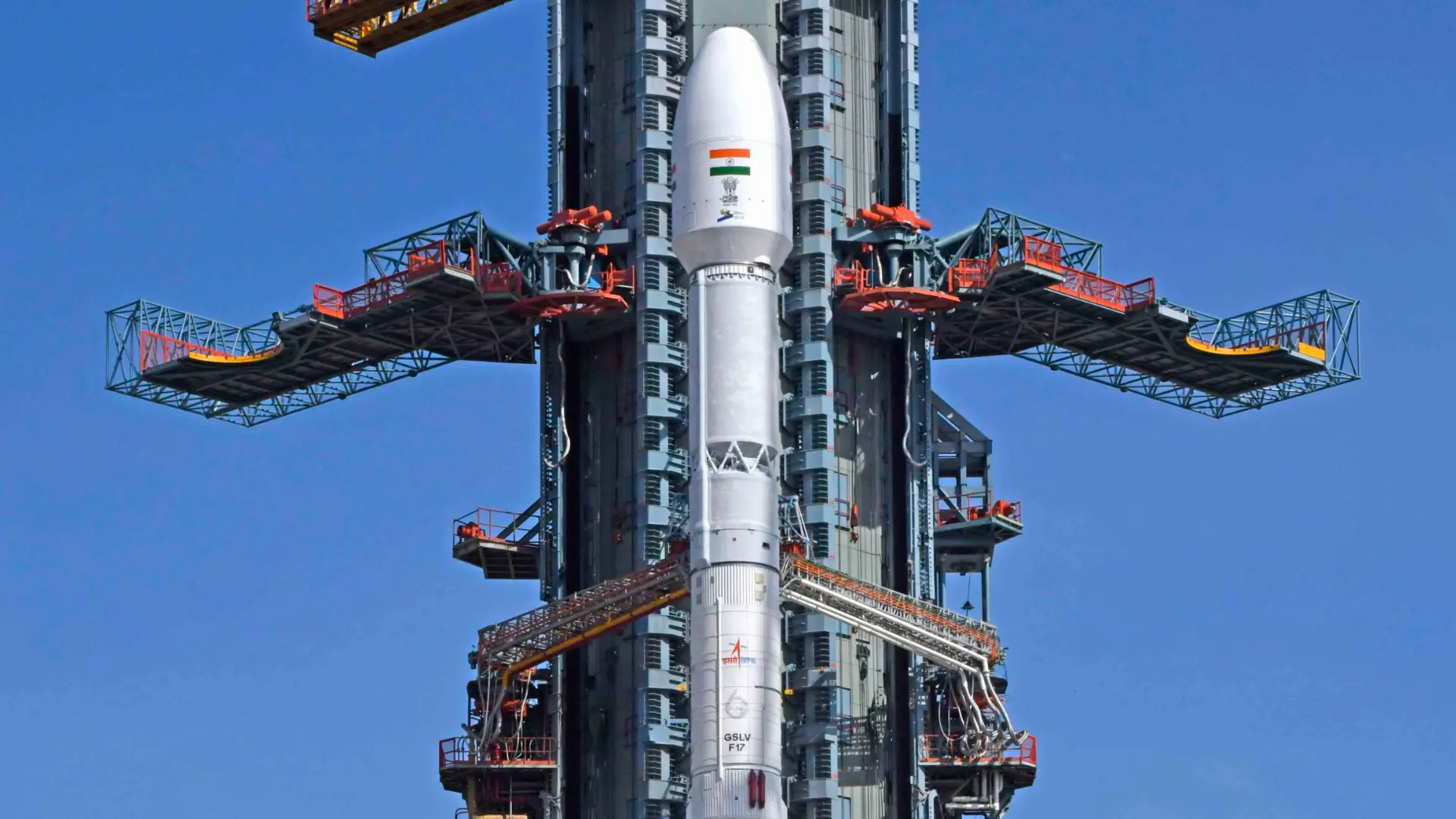
Five hundred kilometres above Earth, a tactical reconnaissance satellite streaks past at twenty-seven thousand kilometres per hour, surveys a contested Himalayan valley for ninety seconds, and vanishes over the southern horizon. It will not return to that identical coordinate for three to five days. At thirty-six thousand kilometres, the sensor platform never departs. With the liftoff of the GSLV-F17 mission from the Satish Dhawan Space Centre in Sriharikota, India has formally operationalised its first sovereign geosynchronous imaging satellite, locking an unblinking electro-optical gaze across the Line of Actual Control (LAC), the Line of Control (LoC), and the northern approaches of the Indian Ocean Region (IOR).
The spacecraft, officially designated EOS-05 (and programmatically catalogued as GISAT-1A), weighs approximately 2,268 kilograms and represents a qualitative doctrinal pivot anchored by an indigenous geosynchronous imaging satellite. For two decades, military planners under the Integrated Defence Staff (IDS) and the Defence Space Agency (DSA) have relied on polar Low Earth Orbit (LEO) constellations such as Cartosat-2/3 and the synthetic aperture radar eyes of RISAT-2B. While these platforms supply exceptional sub-metre tactical clarity, their celestial mechanics enforce a severe limitation: predictable revisit latency. By deploying an indigenously engineered geosynchronous imaging satellite, India eliminates the temporal visibility gaps that regional adversaries have historically exploited to conceal logistical build-ups and troop repositioning.
Orbital Physics: Why a Geosynchronous Imaging Satellite Erases Revisit Latency
The operational divide between Low Earth Orbit and Geostationary Orbit is governed by celestial velocity. Satellites orbiting at altitudes between 400 and 700 kilometres travel at roughly 7.5 kilometres per second to counterbalance terrestrial gravity. As a consequence, their sensors sweep across a given geographical sector in mere minutes before orbital momentum carries them across the poles. Even with agile off-nadir steering, an adversary possessing basic telemetry ephemeris data can schedule logistical convoys, artillery relocation, and pontoon bridging during known satellite blind spots.
In contrast, EOS-05 operates at the Clarke belt altitude of 35,786 kilometres. At this precise distance, the orbital period synchronises perfectly with the sidereal rotation of the Earth. The satellite appears stationary relative to ground stations in Bengaluru and Shadnagar, transforming the payload into a permanent geosynchronous imaging satellite watchtower over South Asia. Published mission documentation from the Indian Space Research Organisation (ISRO) confirms that EOS-05 is equipped with high-resolution multi-spectral optical and hyperspectral imagers capable of generating full-disc regional frames every thirty minutes and tactical sub-swaths in under five minutes.
Deploying a persistent geosynchronous imaging satellite enables military planners to build automated change-detection pipelines. When a forward runway along the Tibetan plateau experiences sudden surface-heat variations or an access road across Aksai Chin shows fresh earthwork disturbance, the satellite’s algorithms register an anomaly in minutes, bypassing the delays inherent in legacy intelligence cycles as analysed in The Eastern Strategist Strategic Intelligence archives.
Himalayan Deterrence: Operational Doctrine Across the LAC and Northern IOR
The primary tactical hurdle along the 3,488-kilometre LAC has never been a lack of resolution; it has been the tyranny of geographic scale and terrain contouring. In the high-altitude ravines of Ladakh, Sikkim, and Arunachal Pradesh, weather windows fluctuate violently within hours. Prior to the induction of an operational geosynchronous imaging satellite, Indian commanders required satellite scheduling requests through the Defence Imagery Processing and Analysis Centre (DIPAC), often waiting for the orbital alignment of Cartosat-3 or RISAT-2BR1 to confirm forward build-ups.
Under the revised operational architecture formulated by the Defence Space Agency, this geosynchronous imaging satellite serves as an indispensable early-warning tripwire. The platform does not replace Low Earth Orbit platforms; rather, it directs them. When EOS-05 detects anomalous vehicular dispersal or bridge construction along forward valleys, it generates an automated geographic cue. Triggered by initial surveillance cues from the geosynchronous imaging satellite, high-resolution optical assets, high-altitude long-endurance (HALE) unmanned aerial vehicles, or Navy P-8I Neptune aircraft are tasked to perform surgical target verification.
The doctrine applies equally across the maritime domain. In the northern Indian Ocean, through which critical sea lines of communication transit, naval task forces require uninterrupted surface visibility. Operating as a wide-aperture geosynchronous imaging satellite, EOS-05 monitors the choke points of the Gulf of Aden, the Strait of Hormuz, and the Malacca approaches, detecting warship wakes, auxiliary supply replenishment, and clandestine transponder-dark tanker transfers, reinforcing the maritime equilibrium outlined in The Eastern Strategist Strategic Analysis dossier.
The 2021 Cryogenic Redux: Validating the GSLV-F17 Upper Stage
To appreciate the strategic significance of the 4 September 2026 launch, one must revisit the setback of 12 August 2021. On that morning, the GSLV-F10 rocket lifted off carrying the predecessor spacecraft, GISAT-1. Five minutes into flight, following nominal performance of the core solid booster and liquid strap-on stages, the cryogenic upper stage failed to ignite. Telemetry indicated that a technical malfunction in the fuel booster turbo-pump (FBTP) prevented liquid hydrogen from reaching the combustion chamber, resulting in mission failure and the loss of the satellite.
The subsequent Failure Analysis Committee (FAC) instituted sweeping modifications across the CUS architecture. According to the ISRO GSLV-F17 Technical Mission Brochure, engineers at the Liquid Propulsion Systems Centre (LPSC) in Valiyamala redesigned the cryogenic vent and relief valves, upgraded the thrust chamber pyrotechnic igniters, and integrated redundant propellant feed line pressure transducers. The 51.7-metre, three-stage vehicle—historically nicknamed the ‘naughty boy’ due to past cryogenic volatility—now exhibits an established launch cadence, validating India’s capability to lift payloads exceeding 2,200 kilograms into Geostationary Transfer Orbit (GTO).
Establishing domestic cryogenic reliability is an existential requirement for India’s space sovereignty. Without a flight-proven vehicle to launch each next-generation geosynchronous imaging satellite, India would remain vulnerable to foreign commercial launch providers for deploying heavy military communications satellites such as GSAT-7R and the prospective multi-band space surveillance network.
Aerospace Equities: Supply Chain Windfalls Across India’s Defence Primes
Beyond orbital mechanics and deterrence postures, the GSLV-F17 mission highlights the financial and industrial evolution of India’s aerospace industrial ecosystem. What was previously an in-house laboratory manufacturing model managed strictly within ISRO centres has systematically migrated to private industry primes and defence public sector undertakings (DPSUs), aligned with national procurement guidelines tracked in The Eastern Strategist India Defence Section.
| Company Name | System / Hardware Contribution | Order Book / Strategic Role | Industrial Footprint |
|---|---|---|---|
| Hindustan Aeronautics Limited (HAL) | Payload fairing, inter-stage structures, light alloy propellant tanks | Lead integrator for prospective commercial PSLV/LVM3 consortia | Aerospace Division, Bengaluru |
| Larsen & Toubro (L&T) | Solid booster motor casings (S139), umbilical launch tower integration | Co-lead in launch vehicle serialisation and propellant handling | Precision Engineering Hub, Coimbatore / Hazira |
| MTAR Technologies | Cryogenic engine injectors, liquid propulsion valves, turbo-pump sub-assemblies | Sole-source and Tier-1 supplier for CE-7.5 / CE-20 cryogenic engines | Precision Machining Facilities, Hyderabad |
| Data Patterns (India) | Launch vehicle avionics, satellite power control units, telemetry processing cards | Expanding defence and aerospace electronics backlog | Electronic Systems Campus, Chennai |
| Bharat Electronics Limited (BEL) | Ground station telemetry receivers, optical sensor focal plane readouts | Tier-1 electro-optics and C4ISR military command integration | Opto-Electronics & Radar Units, Kotdwara / Pune |
The institutional demand environment has structurally changed. With the Cabinet Committee on Security (CCS) approving phased capital allocations exceeding ₹8,400 crore for sovereign geosynchronous imaging satellite architectures and space capabilities—including the Defence Space Agency’s multi-satellite tactical constellation—component suppliers are experiencing a fundamental valuation re-rating. Multi-year framework contracts are replacing annual ad-hoc purchase orders, providing Tier-1 and Tier-2 suppliers with five-year revenue visibility and higher operating margins.
Atmospheric Realities: The Optical Constraints of GEO Stare
Objective intelligence analysis requires stripping away hyperbole. While commissioning an operational geosynchronous imaging satellite into high orbit is an undeniable operational milestone, electro-optical physics imposes inescapable constraints. At a distance equivalent to circling the Earth’s equator nearly once over, capturing sub-metre detail demands optical mirrors of impractical diameter and mass. EOS-05’s 42-metre spatial resolution excels at identifying newly paved tarmac, substantial encampments, aircraft dispersal on aprons, and vessel movements; it cannot decipher licence plates or confirm infantry weapon configurations.
Furthermore, optical and infrared imagers cannot penetrate dense meteorological cloud decks. Along the rugged crest lines of the Karakoram and eastern Himalayas, cloud obscuration persists for months during the southwest monsoon. An adversary operating under cloud cover remains shielded from electro-optical gaze, necessitating continuous coordination with radar-equipped polar orbiters such as RISAT-2B.
The ultimate frontier for Indian military space planners is the development of a high-aperture Geostationary Synthetic Aperture Radar (GEO-SAR). A radar satellite operating in geosynchronous orbit would pulse radio waves through clouds, torrential rain, and nighttime darkness, providing an all-weather, twenty-four-hour sovereign stare. Until ISRO and the Defence Research and Development Organisation (DRDO) achieve that technological threshold, EOS-05 represents the decisive first half of India’s high-altitude orbital shield.
Verified Sourcing and Documentation
- Primary Launch Authority: Indian Space Research Organisation (ISRO) GSLV-F17 / EOS-05 Mission Profile
- Technical Flight Specifications: ISRO GSLV-F17 Vehicle Configuration and Payload Characteristics Brochure
- Strategic Assessment: The Economic Times: Deployment of Persistent Geosynchronous Frontier Surveillance
- National Security Analysis: The Times of India: Strategic Impact of EOS-05 Orbit Over China and Pakistan Borders
- TES Cross-Analysis: Internal references from The Eastern Strategist Strategic Intelligence Hub and The Eastern Strategist Strategic Analysis.